 |
| Wyoming |
However today as I woke around 8AM (not sure what time zone, 2 hr difference) was checking the SPC, NOAA and a couple other sites and saw that the storms were tracking farther east than anticipated. Unfortunately we would have had to drive to Kansas City/ middle parts of Missouri for a less than 10% chance of seeing anything. After a couple more hours of sleep I checked again and realized that tomorrow, Saturday, is setting up to be a record breaking type day. Not to alarm anyone but it is what is considered a "High Risk" outlook.
http://www.spc.noaa.gov/products/outlook/day2otlk.html
What does this mean? Alot... Four major cities (Oklahoma City, Wichita, Omaha, Kansas City) are in the cross hairs for what could be a deadly day. We have already decided to drive to Wichita tonight to set up camp and then drive to an open area with a large road network away from any cities or debris for our chase day. We are going to take precautions tomorrow because with a day like this, safety first.
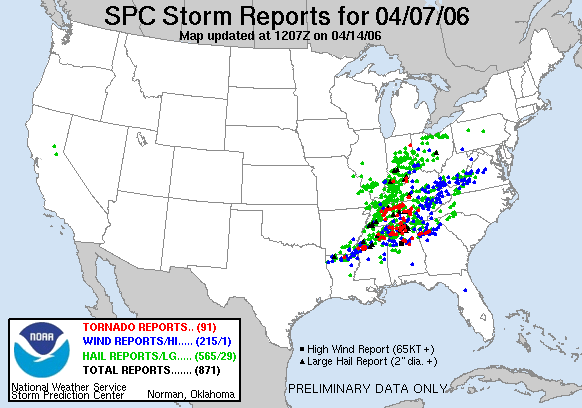
Secondly this is what they consider to be a outbreak day, or multiple tornadoes. How many? Well for reference the last time a "high risk" was posted a day in advance was in April 7th 2006 where over 91 tornadoes spawned stretching 9 different states.
I don't think that we could have picked a better weekend to be chasing. (Sorry mom). Ill post again tonight to give a target area of where we will be in the morning.
No comments:
Post a Comment